ÇINARLISU MOUNTAIN BIKING TRAIL
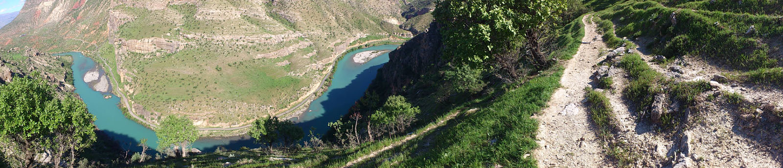
The 10 km route starts from the road between Tillo and Çınarlısu. the altitude at the starting point is 975 meters, whereas it is 715 meters at the ending point. The route is categorized as "Medium" level and it is suitable for hiking besides mountain biking. No water source is found along the road which ends on a rocky cliff with a spectacular view of the Botan Valley.
The mobile phone coverage of Turkcell, Vodaphone and Avea is available at some points along the road. The coordinate of these points are given in the GPX and KML files.
Please click here to see the route that goes from Siirt downtown to the beginning of Çınarlısu Mountain Biking Trail.
Details of the route

Starting 1 km from Çınarlısu, the 4 km long mountain road has a good surface for mountain biking.
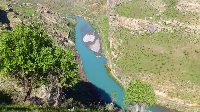
The road ends at a point with a nice scenery of the Botan River.

The ending point is one of the most narrow section of the Botan Valley.
